


NEWS
Earth Day: Human Impact on The Chinese Landscape
NASA satellite images show how much China has changed.
By Yang Shenlai
From the coastal flats in the east to the mountain ranges in the west, China’s natural landscape has changed dramatically over the past few decades. Below, satellite images from NASA show humans’ impact on the planet, including urban expansion, agricultural growth, and man-made environmental hazards.
1 of 24
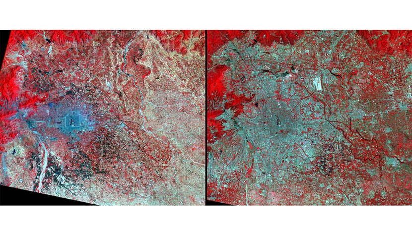
Many who were sent to the countryside during the Cultural Revolution returned to Beijing in the 1970s. Others came seeking jobs. In the 1980s, industrial plants were moved from the central city to outlying areas.
1 of 24
Urban growth — Beijing, 1977: The blue area represents buildings and pavement, while the red area shows natural and agricultural vegetation. Landsat 2 and 5/Earthshots/Satellite Images of Environmental Change, U.S. Geological Survey
1 of 24
Urban growth — Beijing, 2011: The blue area represents buildings and pavement, while the red area shows natural and agricultural vegetation. Landsat 2 and 5/Earthshots/Satellite Images of Environmental Change, U.S. Geological Survey
1 of 24
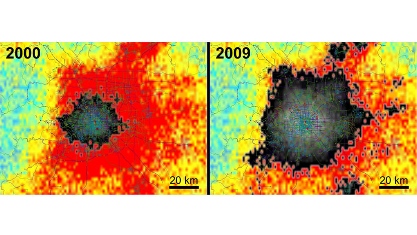
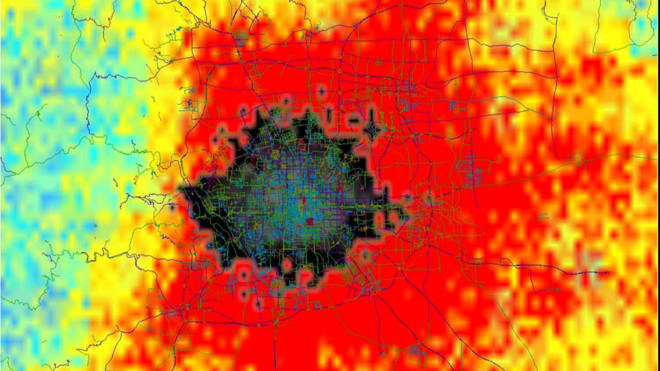
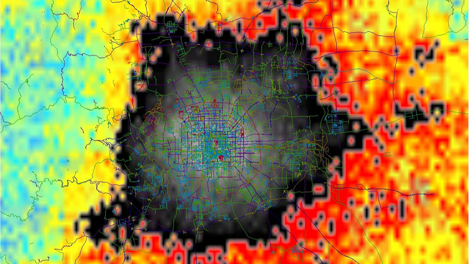
Urban growth — Beijing, 2000 to 2009: A study showed that Beijing’s physical infrastructure quadrupled from 2000 to 2009. New buildings and roads caused winter temperatures to rise by 3 to 4 °C and reduced wind speed by 2 to 7 miles per hour.
1 of 24
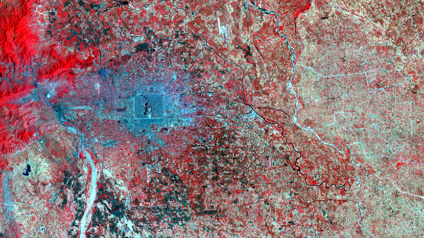
Urban growth — Beijing, 2000: The grey-black area indicates buildings. In not-yet-urbanized areas, blue-green indicates the least change, yellow-orange more change, and red the greatest change. NASA’s QuikScat satellite/NASA/JPL-Caltech
1 of 24
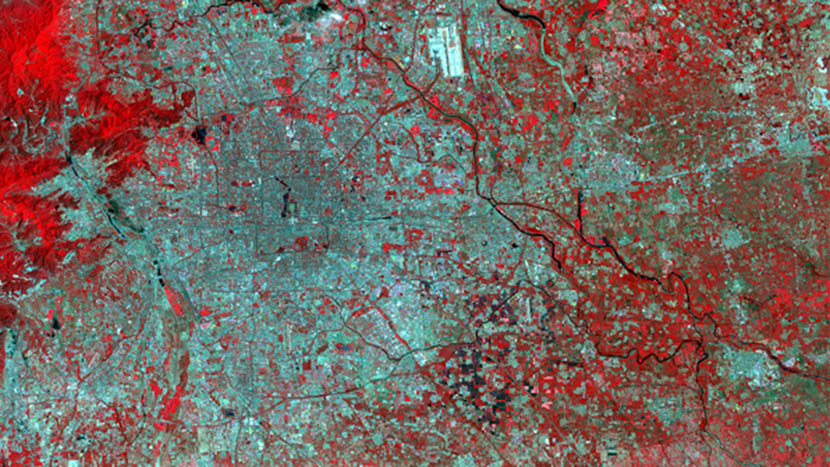
Urban growth — Beijing, 2009: The grey-black area indicates buildings. In not-yet-urbanized areas, blue-green indicates the least change, yellow-orange more change, and red the greatest change. NASA’s QuikScat satellite/NASA/JPL-Caltech
1 of 24
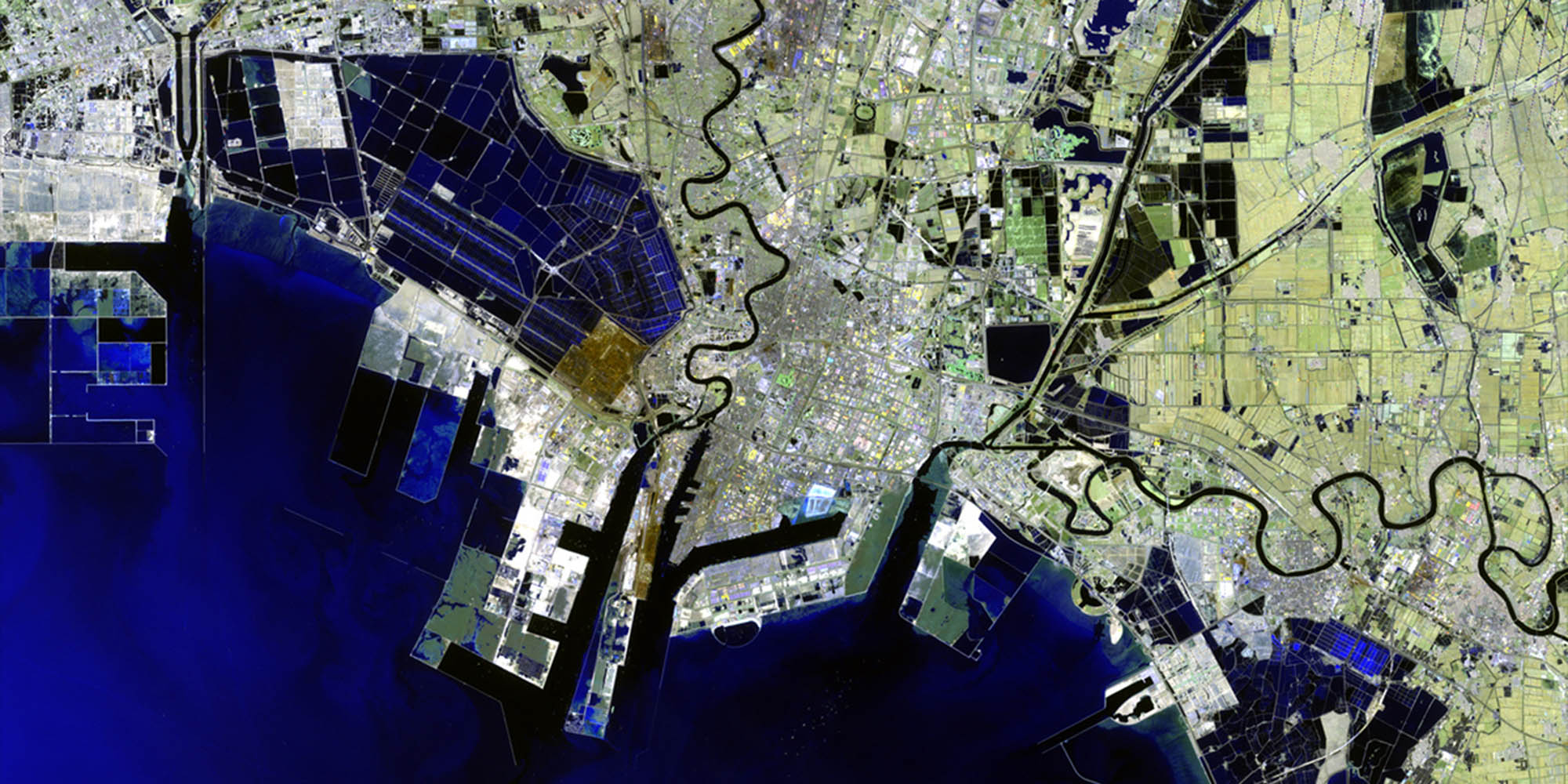
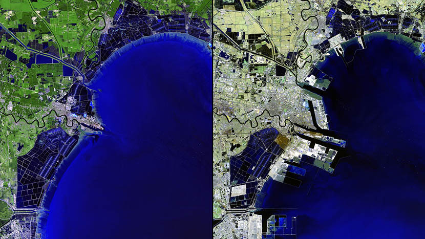
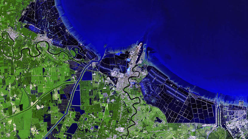
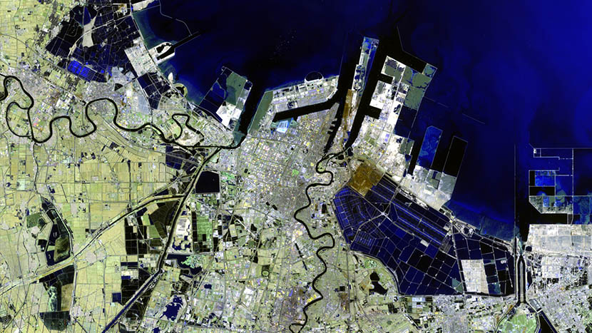
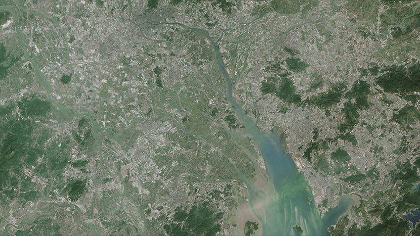
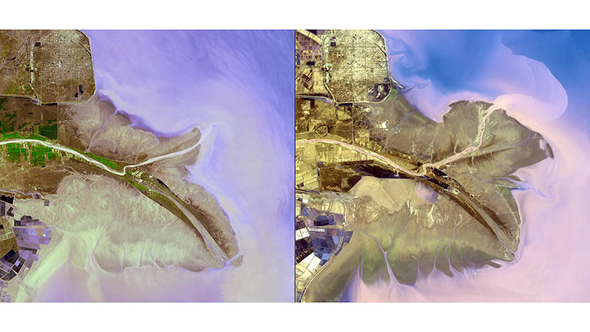
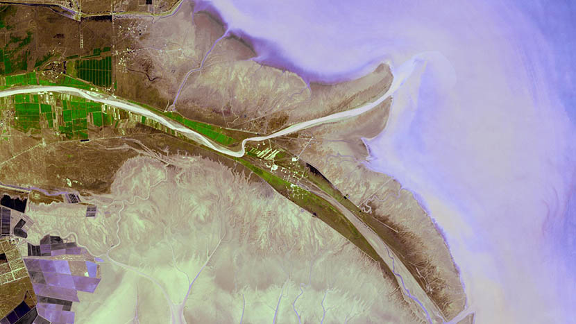
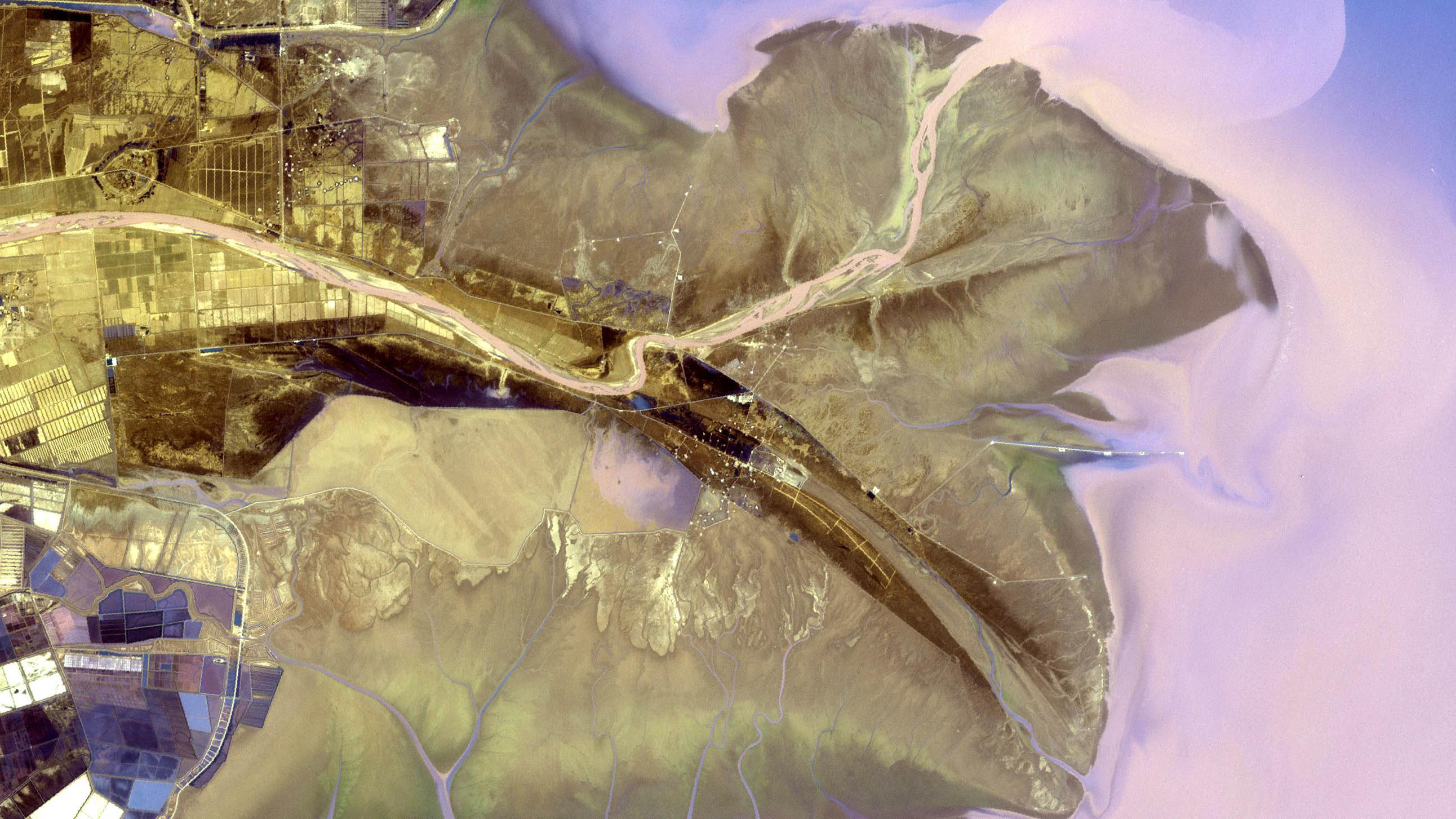
Artificial land and urban growth — Tianjin, 1992 to 2012: The Binhai New City in Tianjin, once home to salt farms, reed marshes and wasteland, has grown into one of China’s key economic hubs.
1 of 24
Artificial land and urban growth — Tianjin, 1992: The image is rotated 90 degrees. Thematic Mapper sensor onboard Landsat 5/U.S. Geological Survey (USGS) Landsat Missions Gallery, ‘Binhai New Area, China,’ U.S. Department of the Interior/USGS
1 of 24
Artificial land and urban growth — Tianjin, 2012: This image is rotated 90 degrees. Thematic Mapper sensor onboard Landsat 5/U.S. Geological Survey (USGS) Landsat Missions Gallery, ‘Binhai New Area, China,’ U.S. Department of the Interior/USGS
1 of 24
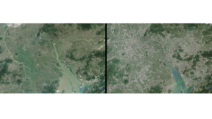
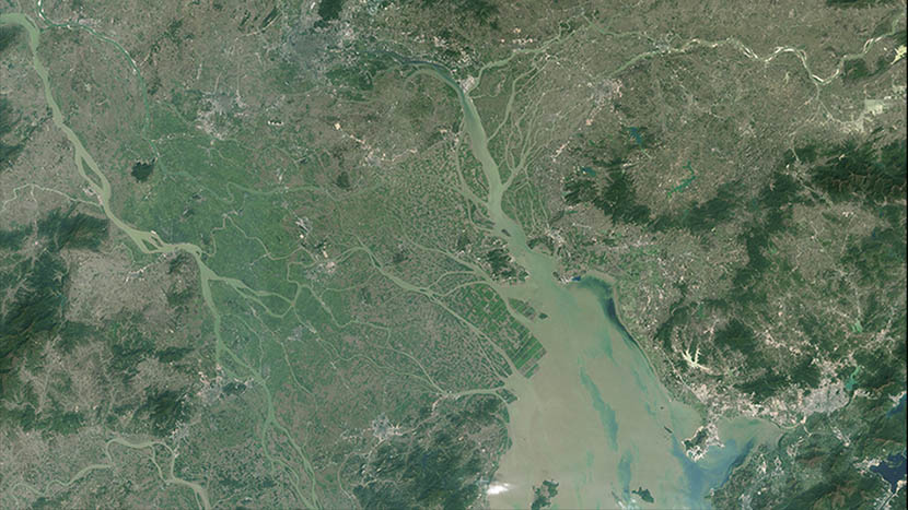
Expanding megalopolis — Pearl River Delta, 1988 to 2014: In 1988 the Pearl River Delta was a network of rivers among rice paddies, wheat fields, mulberry orchards, and fish ponds. Nearly 30 years later, its cities have ballooned into a megalopolis.
1 of 24
Expanding megalopolis — Pearl River Delta, 1988: Rural areas, mainly farmland and forest, appear green. Urban areas are gray and white. Thematic Mapper sensor onboard Landsat 5 and the Operational Land Imager onboard Landsat 8/NASA Earth Observatory
1 of 24
Expanding megalopolis — Pearl River Delta, 2014: Rural areas, mainly farmland and forest, appear green. Urban areas are gray and white. Thematic Mapper sensor onboard Landsat 5 and the Operational Land Imager onboard Landsat 8/NASA Earth Observatory
1 of 24
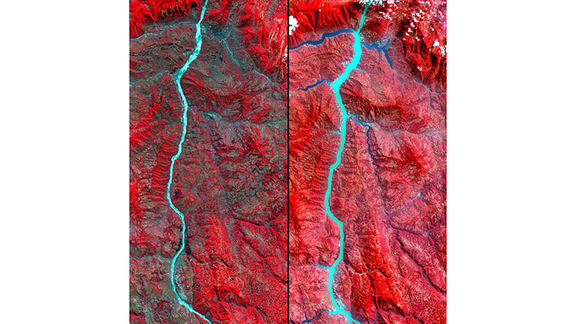
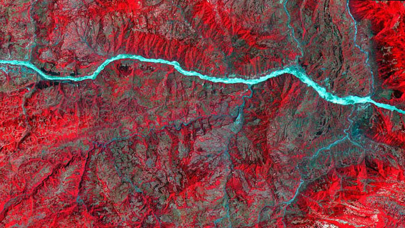
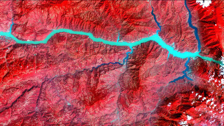
Dam impact — Yangtze River, 2001 to 2003: Left: May 20, 2001. Right: March 25, 2003. Both images are taken west of the Three Gorges Dam (at top of the images), the world’s largest — and most controversial — hydroelectric power project.
1 of 24
Dam impact — Yangtze River, May 20, 2001: This image was taken during the dam’s construction, before the reservoir was filled. MISR instrument onboard NASA’s Terra spacecraft/NASA/GSFC/METI/ERSDAC/JAROS and the U.S./Japan ASTER Science Team
1 of 24
Dam impact — Yangtze River, March 25, 2003: This image shows the partial filling of the reservoir, including numerous side canyons. MISR instrument onboard NASA’s Terra spacecraft/NASA/GSFC/METI/ERSDAC/JAROS and the U.S./Japan ASTER Science Team
1 of 24
Delta growth — Yellow River Delta, 1985 to 2014: Yellow River (Huang He) is the most sediment-rich river on Earth. Each year it transports millions of tons of soil to a delta in the Bohai Sea. These images show the delta’s growth from 1985 to 2014.
1 of 24
Delta growth — Yellow River Delta, 1985: Thematic Mapper onboard Landsat 5 and Operational Land Imager onboard Landsat 8/U.S. Geological Survey Landsat Missions Gallery ‘Huang He Delta and Lauzhou Bay,’ U.S. Department of the Interior/USGS and NASA
1 of 24
Delta growth — Yellow River Delta, 2014: Thematic Mapper onboard Landsat 5 and Operational Land Imager onboard Landsat 8/U.S. Geological Survey Landsat Missions Gallery ‘Huang He Delta and Lauzhou Bay,’ U.S. Department of the Interior/USGS and NASA
1 of 24
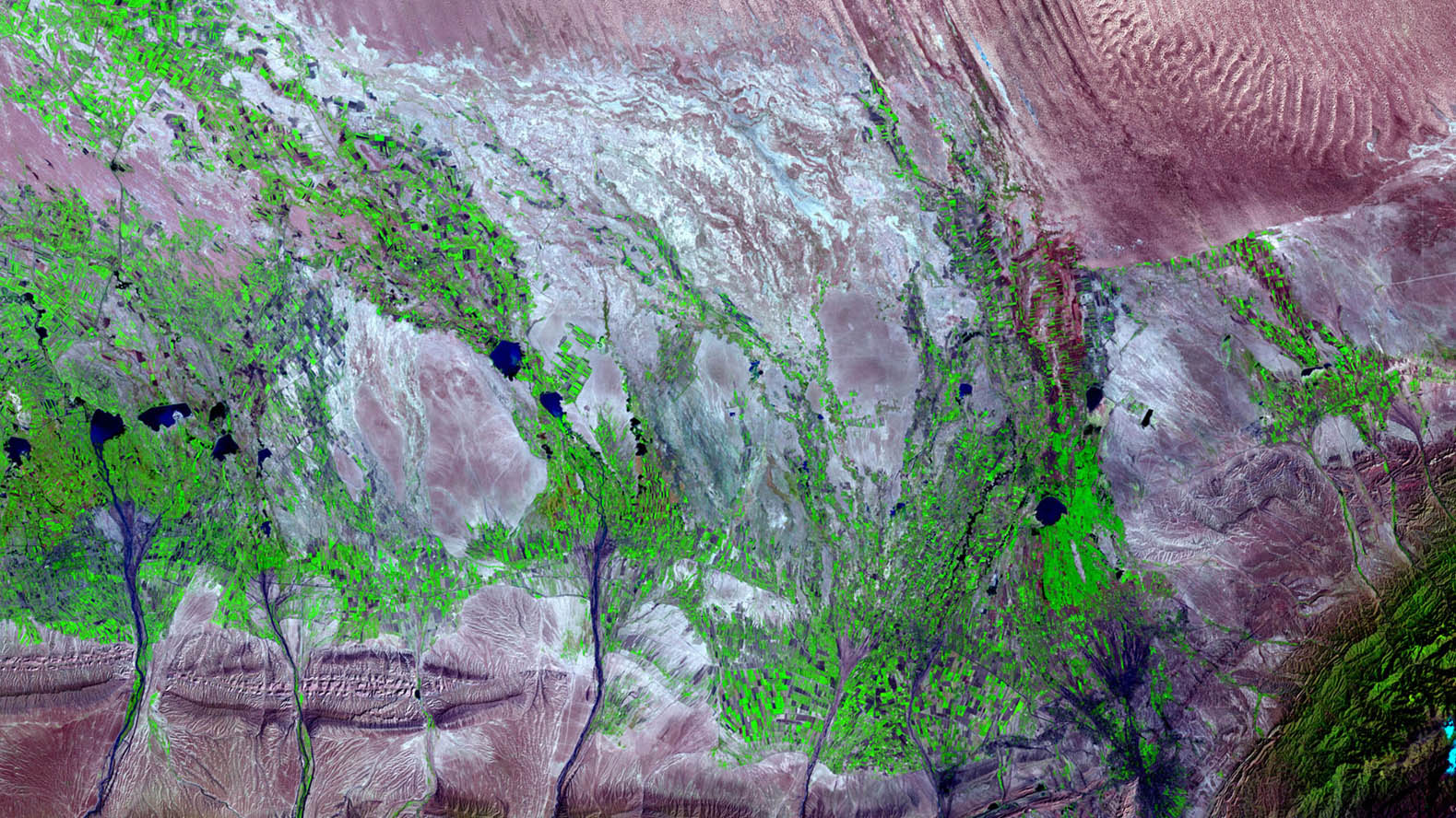
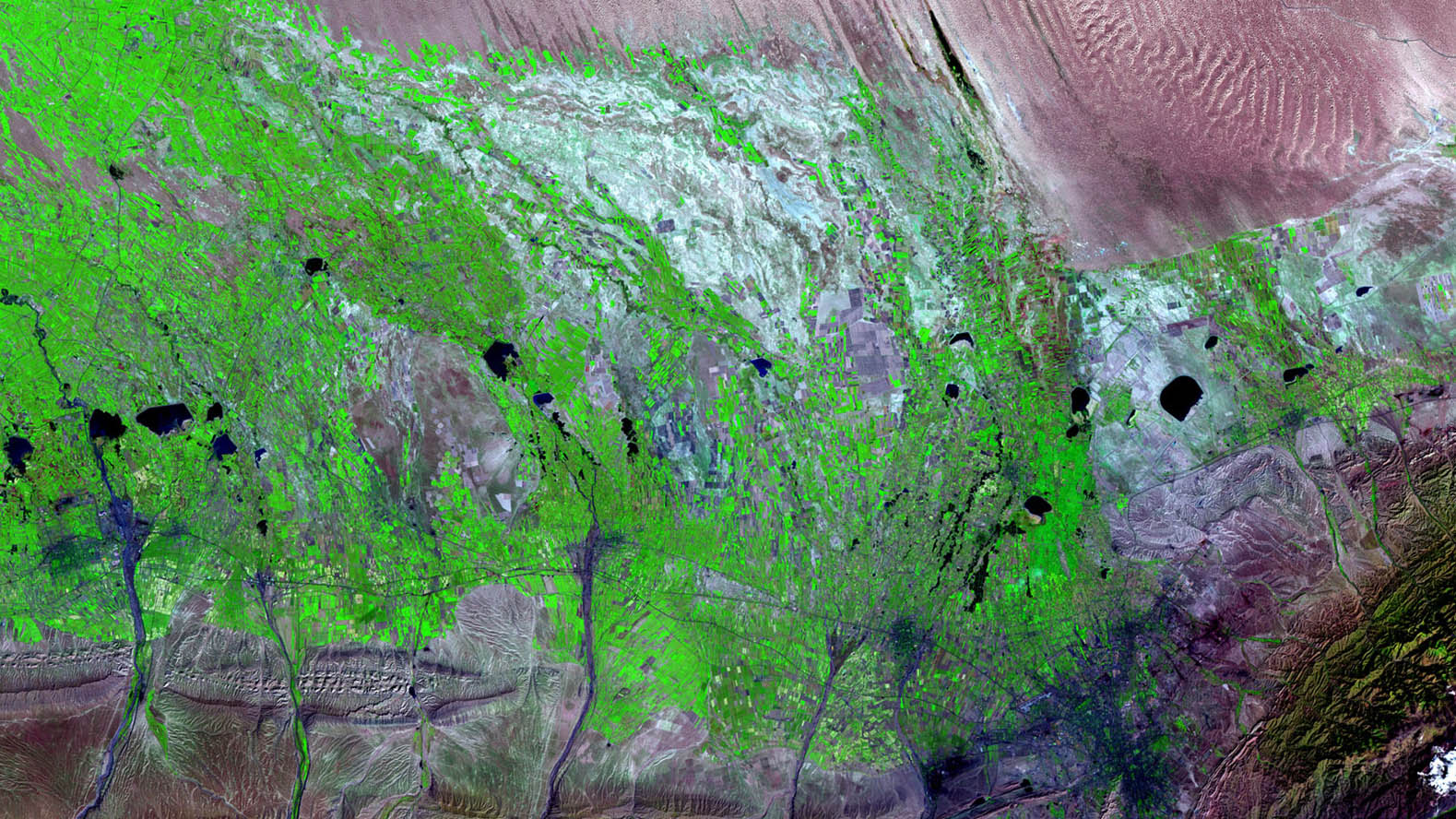
Agricultural growth — Xinjiang Uyghur Autonomous Region, 1989 to 2010: Fertile land, low population density, few industrial enterprises. The region’s relative isolation allows crops to avoid disease and insects with minimal application of chemicals.
1 of 24
Agricultural growth — Xinjiang Uyghur Autonomous Region, Sept. 3, 1989: Thematic Mapper sensor aboard Landsat 4/USGS Landsat Missions Gallery, U.S. Department of the Interio /U.S. Geological Survey
1 of 24
Agricultural growth — Xinjiang Uyghur Autonomous Region, Sept. 21, 2010: ‘Green’ cropland has expanded in this area. Thematic Mapper sensor aboard Landsat 5/USGS Landsat Missions Gallery, U.S. Department of the Interior/U.S. Geological Survey

1 of 24
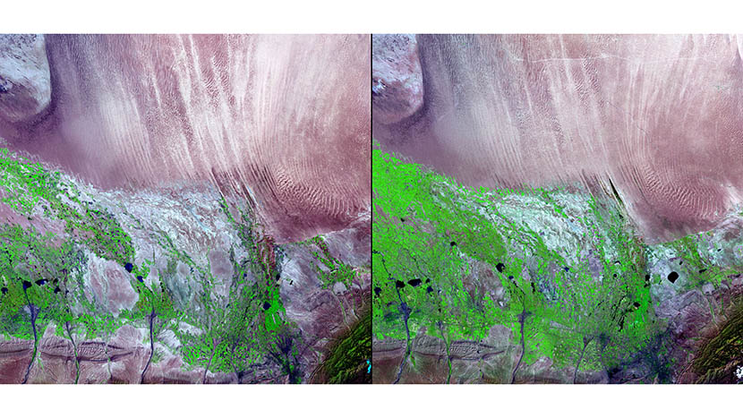
Dust storm — Liaoning province, March 23 to April 8, 2002: Storms transport both mineral dust and pollution great distances. Thick dust clouds block incoming sunlight. NASA’s Multi-angle Imaging Spectroradiometer (MISR)/NASA/GSFC/LaRC/JPL, MISR Team
1 of 24
Dust storm — Liaoning province, March 23, 2002: A relatively clear day. NASA’s Multi-angle Imaging Spectroradiometer (MISR)/NASA/GSFC/LaRC/JPL, MISR Team

1 of 24
Dust storm — Liaoning province, March 23, 2002: A day of extremely dusty skies. NASA’s Multi-angle Imaging Spectroradiometer (MISR)/NASA/GSFC/LaRC/JPL, MISR Team
(Header image: This image shows artificial land and urban growth in Binhai New City, Tianjin, 2012. The image is rotated 90 degrees. Thematic Mapper sensor onboard Landsat 5/U.S. Geological Survey (USGS) Landsat Missions Gallery, ‘Binhai New Area, China,’ U.S. Department of the Interior/USGS)
SUBSCRIBE TO OUR NEWSLETTER
Submit
By submitting, you agree to our Terms Of Use.
*Please enter an email address.


